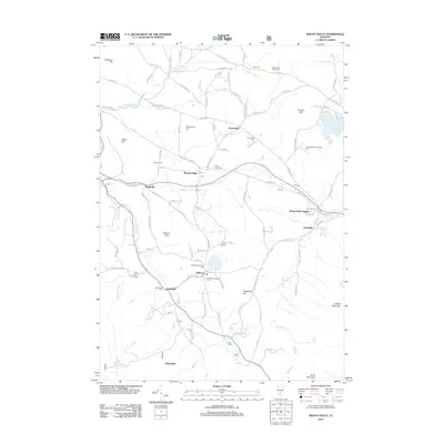
2012 Map of Mount Holly
USGS Topo · Published 2012About this map
Mount Holly and its surrounding hamlets occupy a high-elevation corridor of Windsor County where the Mill River and numerous mountain brooks have shaped local development. The map reveals a cluster of distinct historical settlements, including Belmont, Healdville, and Tarbellville, each connected by a network of early routes such as the Crown Point Rd and Shunpike Rd. This 2012 survey details a landscape characterized by its many small burial grounds, from the Woodward Wilder Cem in the north to the Carlton Cem in the south, reflecting the deep roots of local families. Water features like Star Lake and the substantial Lake Ninevah are central to the terrain, which is flanked by summits like Ludlow Mountain and Hedgehog Hill. This area remains a notable intersection of Vermont's agricultural past and its contemporary mountain-village character.
Find a feature on this map
113 named features on this map. Tap any name to fly to it.
Don’t see what you’re looking for? This feature index may not catch every label — zoom into the map to look around manually.
Map Details
Editions of this 2012 Mount Holly Map
This is the sole edition of this map. No revisions or reprints were ever made.
Other maps of this area

1891 · Rutland
USGS Topo · 1:62,500

1893 · Wallingford
USGS Topo · 1:62,500

1893 · Rutland
USGS Topo · 1:62,500

1911 · Woodstock
USGS Topo · 1:62,500

1913 · Woodstock
USGS Topo · 1:62,500

1928 · Ludlow
USGS Topo · 1:48,000

1929 · Ludlow
USGS Topo · 1:62,500

1932 · Ludlow
USGS Topo · 1:62,500

1943 · Woodstock
USGS Topo · 1:62,500

1950 · Glens Falls
USGS Topo · 1:250,000