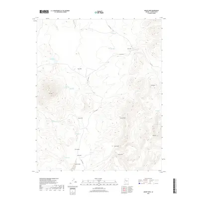
2018 Map of Mount Hope
USGS Topo · Published 2018About this map
Mt Hope dominates the western landscape of this Yavapai County terrain, serving as a high-altitude anchor for a network of springs and drainage washes. This 2018 survey details the complex system of natural water sources vital to this arid region, including Upper Mount Hope Spring and Lower Mount Hope Spring which feed into Hope Wash. The landscape is defined by its seasonal hydrology, with Muddy Wash and Burro Cr carving paths through high-elevation flats like Sawmill Flat. Remote ranching infrastructure is evidenced by scattered water tanks such as Lutcky Tank and Cabin Tank. To the east, the topography rises sharply toward Dairy Mtn and Janes Butte, while Aztec Pass provides a natural corridor through the northern ridges. Access remains limited to primitive routes like Sand Stone Rd and Anvil Rock Rd, reflecting the area's enduring character as an undeveloped expanse.
Find a feature on this map
30 named features on this map. Tap any name to fly to it.
Don’t see what you’re looking for? This feature index may not catch every label — zoom into the map to look around manually.
Map Details
Editions of this 2018 Mount Hope Map
This is the sole edition of this map. No revisions or reprints were ever made.
Other maps of this area

1886 · Diamond Creek
USGS Topo · 1:250,000

1886 · Chino
USGS Topo · 1:250,000

1887 · Prescott
USGS Topo · 1:250,000

1891 · Chino
USGS Topo · 1:250,000

1892 · Diamond Creek
USGS Topo · 1:250,000

1892 · Prescott
USGS Topo · 1:250,000

1923 · Signal
USGS Topo · 1:250,000

1942 · Signal
USGS Topo · 1:250,000

1947 · Turkey Canyon
USGS Topo · 1:62,500

1947 · Camp Wood
USGS Topo · 1:62,500