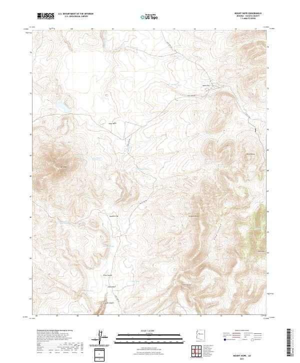
2021 Map of Mount Hope
USGS Topo · Published 2021About this map
Mt Hope and the surrounding high country of Yavapai County define this landscape, where steep canyons and sharp ridges meet essential water sources. This terrain is characterized by a network of seasonal washes and strategically named water points, such as Upper Mount Hope Spring and Lower Mount Hope Spring, which provided critical relief for travelers and livestock in this arid environment. The presence of Aztec Pass and roads like Anvil Rock Rd indicates a long-standing transit corridor through the mountains, connecting different parts of the territory via the natural breaks in the topography.
Find a feature on this map
29 named features on this map. Tap any name to fly to it.
Don’t see what you’re looking for? This feature index may not catch every label — zoom into the map to look around manually.
Map Details
Editions of this 2021 Mount Hope Map
This is the sole edition of this map. No revisions or reprints were ever made.
Other maps of this area

1886 · Diamond Creek
USGS Topo · 1:250,000

1886 · Chino
USGS Topo · 1:250,000

1887 · Prescott
USGS Topo · 1:250,000

1891 · Chino
USGS Topo · 1:250,000

1892 · Diamond Creek
USGS Topo · 1:250,000

1892 · Prescott
USGS Topo · 1:250,000

1923 · Signal
USGS Topo · 1:250,000

1942 · Signal
USGS Topo · 1:250,000

1947 · Turkey Canyon
USGS Topo · 1:62,500

1947 · Camp Wood
USGS Topo · 1:62,500