1986 Map of Mount Ida
USGS Topo · Published 1987About this map
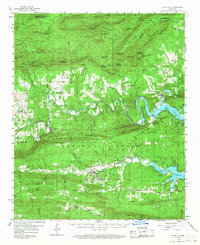
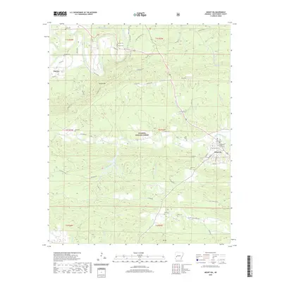
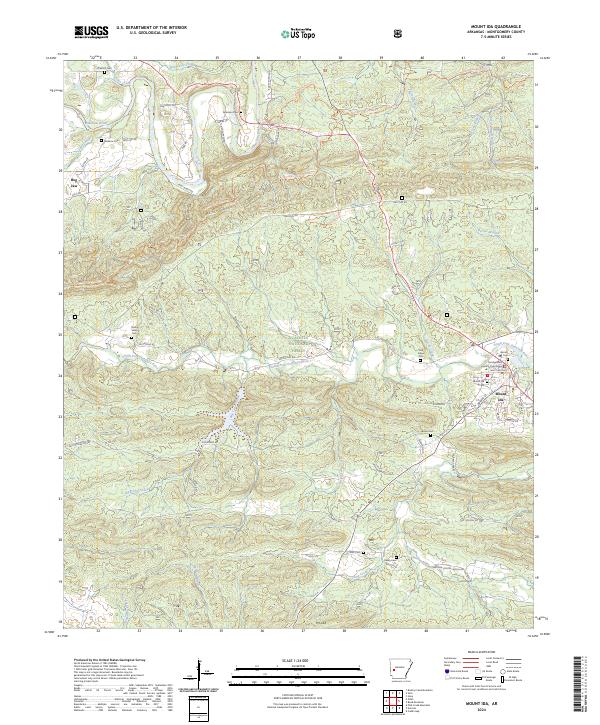
Mount Ida serves as the focal point for this Montgomery County survey, situated where the South Fork Ouachita River meets numerous mountain drainages. The landscape is dominated by the dense woodlands of the Ouachita National Forest and the imposing ridge of Mauldin Mountain, which bisects the northern half of the sheet. Settlement patterns follow the river valleys and creek beds, with small communities such as Hog Jaw, Mauldin, and Barnes connected by a network of rural roads and the Womble Trail. These small clusters of dwellings, often marked simply as Cem or by individual structures, reflect the traditional timber and agricultural heritage of the Ouachita Mountains. The primary Ouachita River meanders through the northwest, featuring a Gaging Station and evidence of local industry at a Gravel Pit. To the south, numerous tributaries like Williams Creek and Crump Creek feed into the river system near the settlement of Owley.
Find a feature on this map
27 named features on this map. Tap any name to fly to it.
Don’t see what you’re looking for? This feature index may not catch every label — zoom into the map to look around manually.
Map Details
Editions of this 1986 Mount Ida Map
This is the sole edition of this map. No revisions or reprints were ever made.
Historical Maps of Mount Ida Through Time
7 maps found