
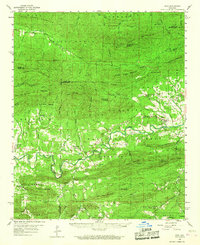
1959 Map of Oden
USGS Topo · Published 1960About this map
The Ouachita River snakes through this 1959 landscape, anchoring a valley of small settlements and family landmarks within the Ouachita National Forest. The town of Oden serves as a local hub near the river, complemented by smaller communities like Pine Ridge and Highland. This survey captures the rural character of the Ouachita Mountains before modern development, where life revolved around the river and the surrounding ridges like Hog Jaw Mountain and Mill Creek Mountain.
Find a feature on this map
72 named features on this map. Tap any name to fly to it.
Don’t see what you’re looking for? This feature index may not catch every label — zoom into the map to look around manually.
Map Details
Editions of this 1959 Oden Map
2 editions found
Other maps of this area

1879 · Poteau Mountain
USGS Topo · 1:62,500

1887 · Poteau Mountain #1
USGS Topo · 1:62,500

1887 · Mount Ida #2
USGS Topo · 1:62,500

1890 · Mount Ida
USGS Topo · 1:125,000

1890 · Poteau Mountain
USGS Topo · 1:125,000

1899 · Poteau Mountain
USGS Topo · 1:125,000

1906 · Caddo Gap
USGS Topo · 1:125,000

1913 · De Queen
USGS Topo · 1:125,000

1936 · Athens
USGS Topo · 1:48,000

1936 · Glenwood
USGS Topo · 1:48,000