1959 Map of Oden
USGS Topo · Published 1967About this map
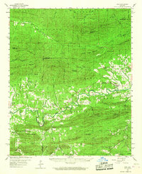
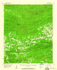
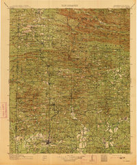
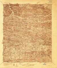
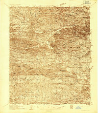
The Ouachita River carves a winding path through the center of this 1950s survey, marking the lifeblood of a landscape defined by the Ouachita National Forest. Settlements like Oden and Pine Ridge serve as focal points for the surrounding rural communities, where life centered on small country churches and family burial grounds. The presence of the Ranger Station and the Gaston Lookout Tower atop Gaston Mountain underscores the importance of forestry management in this period. Local genealogy is well-represented through numerous family-named landmarks, including the Goodner Cem, Edwards Cem, and Huddleston Cem. From the heights of Mill Creek Mountain to the waters of the South Fork Ouachita River, the map documents a network of creeks and ridges that shaped the movement and settlement of the Ouachita region before more modern developments altered the character of these isolated valleys.
Find a feature on this map
76 named features on this map. Tap any name to fly to it.
Don’t see what you’re looking for? This feature index may not catch every label — zoom into the map to look around manually.
Map Details
Editions of this 1959 Oden Map
2 editions found
Other maps of this area

1879 · Poteau Mountain
USGS Topo · 1:62,500

1887 · Poteau Mountain #1
USGS Topo · 1:62,500

1887 · Mount Ida #2
USGS Topo · 1:62,500
1890 · Mount Ida
USGS Topo · 1:125,000

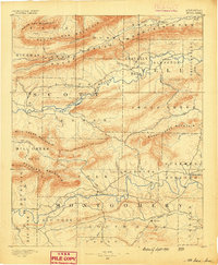
1890 · Poteau Mountain
USGS Topo · 1:125,000

1899 · Poteau Mountain
USGS Topo · 1:125,000
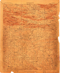
1906 · Caddo Gap
USGS Topo · 1:125,000
1913 · De Queen
USGS Topo · 1:125,000
1936 · Athens
USGS Topo · 1:48,000
1936 · Glenwood
USGS Topo · 1:48,000