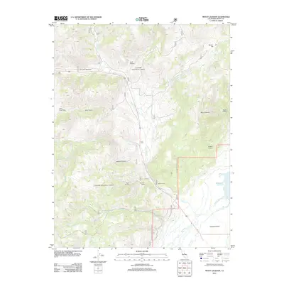
2012 Map of Mount Jackson
USGS Topo · Published 2012About this map
Huntoon Valley and the surrounding high-altitude terrain of Mono County define this landscape as it appeared during the 2012 survey. Centered on the prominence of Mount Jackson, the area is characterized by a series of deep canyons and seasonal watercourses, including Patterson Canyon, Mack Canyon, and Walters Canyon. Settlement is sparse, represented by locations such as Sario Ranch and Huntoon Camp, which reflect the ranching and temporary-settlement patterns typical of this mountainous region. The hydrological network is dominated by Swauger Creek, which flows south toward the Bridgeport Valley. To the east, the map captures a portion of the Bridgeport Reservoir, where various streams like Buckeye Creek and Robinson Creek converge. This survey provides a clear view of the complex drainages and small alpine meadows, such as Pimentel Meadows, that dictate movement through this part of the Sierra Nevada foothills.
Find a feature on this map
25 named features on this map. Tap any name to fly to it.
Don’t see what you’re looking for? This feature index may not catch every label — zoom into the map to look around manually.
Map Details
Editions of this 2012 Mount Jackson Map
This is the sole edition of this map. No revisions or reprints were ever made.
Other maps of this area

1909 · Bridgeport
USGS Topo · 1:125,000

1911 · Bridgeport
USGS Topo · 1:125,000

1920 · Bridgeport
USGS Topo · 1:125,000

1948 · Walker Lake
USGS Topo · 1:250,000

1954 · Chris Flat
USGS Topo · 1:24,000

1954 · Fales Hot Springs
USGS Topo · 1:24,000

1956 · Fales Hot Springs
USGS Topo · 1:62,500

1956 · Matterhorn Peak
USGS Topo · 1:62,500

1957 · Walker Lake
USGS Topo · 1:250,000

1958 · Bodie
USGS Topo · 1:62,500