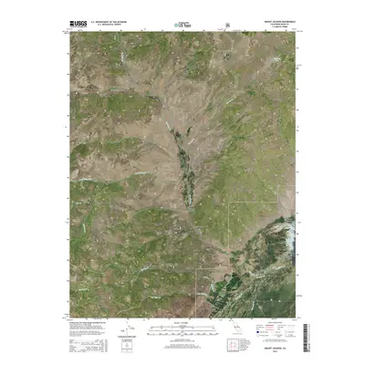
2015 Map of Mount Jackson
USGS Topo · Published 2015About this map
Mount Jackson rises over a high-altitude landscape defined by the drainage basins of the Toiyabe National Forest and the northern reaches of the Bridgeport Valley. The area is characterized by a complex network of canyons and creeks, such as Patterson Canyon and Swauger Cr, which funnel water toward the Bridgeport Reservoir in the southeast. Historical land use in the Sweetwater Mountains is indicated by the many named flats and meadows, including Murphy Flat and Pimentel Meadows, reflecting the region's importance for seasonal grazing. To the west, the New Range and Huntoon Valley showcase the basin-and-range topography typical of the California-Nevada borderlands. The road network remains sparse, with Buckeye Dr providing access to the southern drainages like Buckeye Cr and Robinson Cr, illustrating the persistent character of this territory as a primary location for forest management and watershed protection.
Find a feature on this map
30 named features on this map. Tap any name to fly to it.
Don’t see what you’re looking for? This feature index may not catch every label — zoom into the map to look around manually.
Map Details
Editions of this 2015 Mount Jackson Map
This is the sole edition of this map. No revisions or reprints were ever made.
Other maps of this area

1909 · Bridgeport
USGS Topo · 1:125,000

1911 · Bridgeport
USGS Topo · 1:125,000

1920 · Bridgeport
USGS Topo · 1:125,000

1948 · Walker Lake
USGS Topo · 1:250,000

1954 · Chris Flat
USGS Topo · 1:24,000

1954 · Fales Hot Springs
USGS Topo · 1:24,000

1956 · Fales Hot Springs
USGS Topo · 1:62,500

1956 · Matterhorn Peak
USGS Topo · 1:62,500

1957 · Walker Lake
USGS Topo · 1:250,000

1958 · Bodie
USGS Topo · 1:62,500