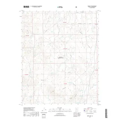
2018 Map of Mount Josh
USGS Topo · Published 2018About this map
Prescott National Forest dominates this interior landscape of Yavapai County, where the high-elevation terrain is defined by dramatic peaks like Mt Josh and Tonto Mtn. The map reveals a complex network of seasonal water sources and ranching infrastructure, characterized by numerous stock tanks such as Toohey Tank, Moana Tank, and Pemberton Tank. Significant drainages including Strickland Wash and Skull Valley Wash carve through the land, while named springs like Bootlegger Spring, Holden Spring, and Sheep Camp Springs suggest a history of human and livestock reliance on these specific points. The road network, including Fair Oaks Rd and Tonto Rd, follows the natural contours of the canyons and ridges. This 2018 survey provides an essential record of the contemporary landscape, showing how modern names like Toohey Trick Tank and El Diamante sit alongside longstanding features like Weed Canyon.
Find a feature on this map
54 named features on this map. Tap any name to fly to it.
Don’t see what you’re looking for? This feature index may not catch every label — zoom into the map to look around manually.
Map Details
Editions of this 2018 Mount Josh Map
This is the sole edition of this map. No revisions or reprints were ever made.
Other maps of this area

1887 · Prescott
USGS Topo · 1:250,000

1892 · Prescott
USGS Topo · 1:250,000

1947 · Simmons
USGS Topo · 1:62,500

1947 · Iron Springs
USGS Topo · 1:62,500

1947 · Sheridan Mountain
USGS Topo · 1:62,500

1947 · Camp Wood
USGS Topo · 1:62,500

1948 · Sheridan Mountain
USGS Topo · 1:63,360

1948 · Iron Springs
USGS Topo · 1:63,360

1948 · Camp Wood
USGS Topo · 1:63,360

1948 · Simmons
USGS Topo · 1:63,360