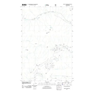
2011 Map of Mount Jupiter
USGS Topo · Published 2011About this map
The Dosewallips River and Duckabush River carve deep valleys through this part of the Olympic Peninsula, defining a landscape of high ridges and isolated outposts. In the northern reaches, a string of backcountry locations including Elkhorn Camp, Tenmile Camp, and Ninemile Camp follow the river corridor along the Dosewallips Rd. These sites reflect the area's long-standing use for forestry and wilderness access, providing specific points of reference for researchers tracing the history of recreation and land management in the region.
Find a feature on this map
28 named features on this map. Tap any name to fly to it.
Don’t see what you’re looking for? This feature index may not catch every label — zoom into the map to look around manually.
Map Details
Editions of this 2011 Mount Jupiter Map
This is the sole edition of this map. No revisions or reprints were ever made.
Other maps of this area

1936 · Point Misery
USGS Topo · 1:62,500

1938 · Mt Constance
USGS Topo · 1:125,000

1940 · Point Misery
USGS Topo · 1:62,500

1940 · Quilcene
USGS Topo · 1:62,500

1946 · Tyler Peak
USGS Topo · 1:62,500

1947 · The Brothers
USGS Topo · 1:62,500

1948 · Tyler Peak
USGS Topo · 1:62,500

1950 · The Brothers
USGS Topo · 1:62,500

1953 · Mt. Walker
USGS Topo · 1:24,000
1953 · Brinnon
USGS Topo · 1:24,000