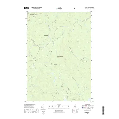
2018 Map of Mount Kineo
USGS Topo · Published 2018About this map
Breezy Point serves as a focal point for this mountain landscape, situated where the Baker River cuts through the high country of the White Mountain National Forest. Historical routes like the Moosilauke Carriage Rd and Old Town Road suggest the early resort and timber access patterns of Grafton County. The terrain is defined by prominent peaks including Mt Kineo, Carr Mtn, and Downing Mtn, which frame the deep basin of Stinson Lake to the south. Hikers and researchers can trace the modern corridor of the Appalachian National Scenic Trail as it crosses the northwestern corner near Hurricane Mtn. Numerous water features, such as Three Ponds and Foxglove Pond, are connected by an extensive network of named winter trails, including the Batchelder Brook Snomo (Snow), reflecting the area's transition into a seasonal recreation hub.
Find a feature on this map
61 named features on this map. Tap any name to fly to it.
Don’t see what you’re looking for? This feature index may not catch every label — zoom into the map to look around manually.
Map Details
Editions of this 2018 Mount Kineo Map
This is the sole edition of this map. No revisions or reprints were ever made.
Other maps of this area

1928 · Plymouth
USGS Topo · 1:62,500

1928 · Rumney
USGS Topo · 1:62,500

1929 · Moosilauke
USGS Topo · 1:62,500

1929 · Franconia
USGS Topo · 1:62,500

1931 · Plymouth
USGS Topo · 1:62,500

1932 · Franconia
USGS Topo · 1:62,500

1932 · Rumney
USGS Topo · 1:62,500

1932 · Moosilauke
USGS Topo · 1:62,500

1949 · Portland
USGS Topo · 1:250,000

1950 · Lewiston
USGS Topo · 1:250,000