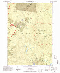
1995 Map of Mount Kineo
USGS Topo · Published 2000About this map
White Mountain National Forest dominates this topographic study, where the peaks of Mount Kineo and Mount Moosilauke define a high-elevation landscape of deep ravines and hiking corridors. The Appalachian National Scenic Trail winds through the northern section, connecting remote outposts like Ravine Lodge and McKenney Cabin. This mid-1990s revision reveals the intricate network of the Hubbard Brook Experimental Forest, a dedicated research area characterized by numerous gauged brooks like Hubbard Brook and Blodgett Brook.
Find a feature on this map
61 named features on this map. Tap any name to fly to it.
Don’t see what you’re looking for? This feature index may not catch every label — zoom into the map to look around manually.
Map Details
Editions of this 1995 Mount Kineo Map
This is the sole edition of this map. No revisions or reprints were ever made.
Other maps of this area

1928 · Plymouth
USGS Topo · 1:62,500

1928 · Rumney
USGS Topo · 1:62,500

1929 · Moosilauke
USGS Topo · 1:62,500

1929 · Franconia
USGS Topo · 1:62,500

1931 · Plymouth
USGS Topo · 1:62,500

1932 · Franconia
USGS Topo · 1:62,500

1932 · Rumney
USGS Topo · 1:62,500

1932 · Moosilauke
USGS Topo · 1:62,500

1949 · Portland
USGS Topo · 1:250,000

1950 · Lewiston
USGS Topo · 1:250,000