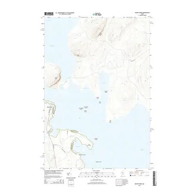
2014 Map of Mount Kineo
USGS Topo · Published 2014About this map
Moosehead Lake dominates this northern Maine landscape, where the prominent peak of Mount Kineo rises sharply above the water. This 2014 survey captures the geographic complexity of the shoreline, defined by deep inlets like Cowan Cove and Harris Cove, and numerous landforms including Big Dry Point and Cowan Point. The map illustrates a remote wilderness managed through a network of local routes such as Rockwood Rd and Spencer Pond Rd.
Find a feature on this map
37 named features on this map. Tap any name to fly to it.
Don’t see what you’re looking for? This feature index may not catch every label — zoom into the map to look around manually.
Map Details
Editions of this 2014 Mount Kineo Map
This is the sole edition of this map. No revisions or reprints were ever made.
Other maps of this area

1920 · Moosehead Lake
USGS Topo · 1:62,500

1921 · Brassua Lake
USGS Topo · 1:62,500

1922 · Moosehead Lake
USGS Topo · 1:62,500

1923 · Brassua Lake
USGS Topo · 1:62,500

1930 · Moosehead Lake
USGS Topo · 1:62,500

1944 · Brassua Lake
USGS Topo · 1:62,500

1944 · Moosehead Lake
USGS Topo · 1:62,500

1954 · Seboomook Lake
USGS Topo · 1:62,500

1954 · North East Carry
USGS Topo · 1:62,500

1954 · Millinocket
USGS Topo · 1:250,000
Featured Places
- Misery Gore, ME
- Sandbar Tract Township, ME
- East Middlesex Canal Grant Township, ME
- Spencer Bay Township, ME
- Kineo Township, ME