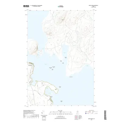
2018 Map of Mount Kineo
USGS Topo · Published 2018About this map
Mt Kineo rises dramatically from the eastern shore of Moosehead Lake, serving as the central landmark for this transition between Somerset and Piscataquis counties. The settlement of Rockwood sits at the western edge of the water, where a network of local thoroughfares like Village Rd and Old Mill Rd reflects the area's long-standing lakeside character. The map details a complex shoreline of protected inlets such as Kineo Cove and Harris Cove, while a chain of islands including West Moody Island, East Moody Island, and Willis Island stretches across the interior waters.
Find a feature on this map
39 named features on this map. Tap any name to fly to it.
Don’t see what you’re looking for? This feature index may not catch every label — zoom into the map to look around manually.
Map Details
Editions of this 2018 Mount Kineo Map
This is the sole edition of this map. No revisions or reprints were ever made.
Other maps of this area

1920 · Moosehead Lake
USGS Topo · 1:62,500

1921 · Brassua Lake
USGS Topo · 1:62,500

1922 · Moosehead Lake
USGS Topo · 1:62,500

1923 · Brassua Lake
USGS Topo · 1:62,500

1930 · Moosehead Lake
USGS Topo · 1:62,500

1944 · Brassua Lake
USGS Topo · 1:62,500

1944 · Moosehead Lake
USGS Topo · 1:62,500

1954 · Seboomook Lake
USGS Topo · 1:62,500

1954 · North East Carry
USGS Topo · 1:62,500

1954 · Millinocket
USGS Topo · 1:250,000
Featured Places
- Misery Gore, ME
- Sandbar Tract Township, ME
- East Middlesex Canal Grant Township, ME
- Spencer Bay Township, ME
- Kineo Township, ME