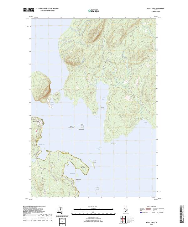
2024 Map of Mount Kineo
USGS Topo · Published 2024About this map
Moosehead Lake dominates this landscape, framing the prominent peninsula of Mt Kineo and the neighboring Little Kineo Mtn. The settlement of Rockwood sits on the western shore, serving as a gateway to the complex network of islands and coves that define the lake's geography. The map illustrates a transition from the elevated peaks of Shaw Mtn down to the low-lying points and islands, such as Masterman Island and Pine Island.
Find a feature on this map
40 named features on this map. Tap any name to fly to it.
Don’t see what you’re looking for? This feature index may not catch every label — zoom into the map to look around manually.
Map Details
Editions of this 2024 Mount Kineo Map
This is the sole edition of this map. No revisions or reprints were ever made.
Other maps of this area

1920 · Moosehead Lake
USGS Topo · 1:62,500

1921 · Brassua Lake
USGS Topo · 1:62,500

1922 · Moosehead Lake
USGS Topo · 1:62,500

1923 · Brassua Lake
USGS Topo · 1:62,500

1930 · Moosehead Lake
USGS Topo · 1:62,500

1944 · Brassua Lake
USGS Topo · 1:62,500

1944 · Moosehead Lake
USGS Topo · 1:62,500

1954 · Seboomook Lake
USGS Topo · 1:62,500

1954 · North East Carry
USGS Topo · 1:62,500

1954 · Millinocket
USGS Topo · 1:250,000
Featured Places
- Misery Gore, ME
- Sandbar Tract Township, ME
- East Middlesex Canal Grant Township, ME
- Spencer Bay Township, ME
- Rockwood Strip T1 R1 NBKP, ME