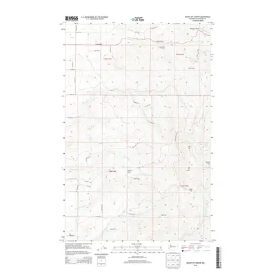
2014 Map of Mount Kit Carson
USGS Topo · Published 2014About this map
Mt Kit Carson and Mt Spokane State Park dominate this 2014 survey of the highlands northeast of Spokane. The landscape is defined by a series of prominent peaks and ridges, including Day Mtn, Beauty Mtn, and the distinctive Blanchard Hump in the northern reaches. This terrain creates a complex watershed where numerous streams, such as Blanchard Cr and Little Deer Cr, descend through steep drainages like Hells Hole.
Find a feature on this map
49 named features on this map. Tap any name to fly to it.
Don’t see what you’re looking for? This feature index may not catch every label — zoom into the map to look around manually.
Map Details
Editions of this 2014 Mount Kit Carson Map
This is the sole edition of this map. No revisions or reprints were ever made.
Other maps of this area

1901 · Spokane
USGS Topo · 1:125,000

1936 · Newport
USGS Topo · 1:96,000

1942 · Newport
USGS Topo · 1:125,000

1943 · Mt Spokane
USGS Topo · 1:62,500

1949 · Deer Park
USGS Topo · 1:62,500

1950 · Mt Spokane
USGS Topo · 1:62,500

1951 · Deer Park
USGS Topo · 1:62,500

1955 · Spokane
USGS Topo · 1:250,000

1958 · Spokane
USGS Topo · 1:250,000

1958 · Sandpoint
USGS Topo · 1:250,000