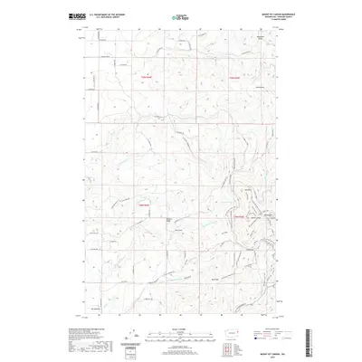
2020 Map of Mount Kit Carson
USGS Topo · Published 2020About this map
Mt Kit Carson and Day Mtn dominate the eastern reaches of this Spokane County landscape, where the terrain transitions into the high ridges and summits of the Selkirk Mountains. The map reveals a complex network of fire roads and recreational routes, including the Upper Kit Carson Loop Road and several segments named for local figures like Jessie Smith. In the southwestern corner, Big Meadows provides a distinct break in the elevation, served by a grid of rural roads such as E Emery Rd and N Darnell Rd. The drainage pattern is defined by numerous seasonal and year-round watercourses like N Fork Little Deep Cr and the curiously named Burping Brook, which carve through the high ground at Smith Gap and Hells Hole. This 2020 survey documents the intersection of public land management and rural development as it existed at the start of the decade.
Find a feature on this map
99 named features on this map. Tap any name to fly to it.
Don’t see what you’re looking for? This feature index may not catch every label — zoom into the map to look around manually.
Map Details
Editions of this 2020 Mount Kit Carson Map
This is the sole edition of this map. No revisions or reprints were ever made.
Other maps of this area

1901 · Spokane
USGS Topo · 1:125,000

1936 · Newport
USGS Topo · 1:96,000

1942 · Newport
USGS Topo · 1:125,000

1943 · Mt Spokane
USGS Topo · 1:62,500

1949 · Deer Park
USGS Topo · 1:62,500

1950 · Mt Spokane
USGS Topo · 1:62,500

1951 · Deer Park
USGS Topo · 1:62,500

1955 · Spokane
USGS Topo · 1:250,000

1958 · Spokane
USGS Topo · 1:250,000

1958 · Sandpoint
USGS Topo · 1:250,000