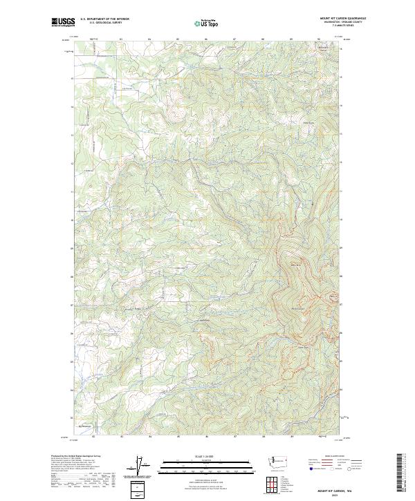
2023 Map of Mount Kit Carson
USGS Topo · Published 2023About this map
Mount Kit Carson and the surrounding heights of Missouri Ridge define this landscape in Spokane County, marked by a dense network of recreational trails and rugged drainage systems. This 2023 survey details the high-elevation terrain between Day Mtn and the Smith Gap saddle, where numerous named pathways like the Mount Spokane Trl and Upper Kit Carson Loop Road Trl navigate the slopes. The map reveals the headwaters of multiple forks of Little Deep Creek and Deadman Creek, illustrating how the topography transitions from the steep peaks of Blanchard Hump down toward the southern expanse of Big Meadows. The grid of sections and townships, including t29n r45e, provides a precise framework for identifying land ownership and forest management boundaries in this highland area.
Find a feature on this map
76 named features on this map. Tap any name to fly to it.
Don’t see what you’re looking for? This feature index may not catch every label — zoom into the map to look around manually.
Map Details
Editions of this 2023 Mount Kit Carson Map
This is the sole edition of this map. No revisions or reprints were ever made.
Other maps of this area

1901 · Spokane
USGS Topo · 1:125,000

1936 · Newport
USGS Topo · 1:96,000

1942 · Newport
USGS Topo · 1:125,000

1943 · Mt Spokane
USGS Topo · 1:62,500

1949 · Deer Park
USGS Topo · 1:62,500

1950 · Mt Spokane
USGS Topo · 1:62,500

1951 · Deer Park
USGS Topo · 1:62,500

1955 · Spokane
USGS Topo · 1:250,000

1958 · Spokane
USGS Topo · 1:250,000

1958 · Sandpoint
USGS Topo · 1:250,000