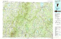
1989 Map of Mount Mansfield
USGS Topo · Published 1989About this map
The Green Mountains define this late twentieth-century landscape, anchoring a region of small villages and glacial lakes near the Canadian border. At the southern edge of this map, Mount Mansfield and the Mt Mansfield State Forest dominate the terrain, while the northern boundary is marked by international crossings at Derby Line and Beebe Plain. The industrial and transport patterns of the era are visible through the paths of the Canadian Pacific RR and the Lamoille Valley RR, which served the river valleys and small manufacturing centers.
Find a feature on this map
150 named features on this map. Tap any name to fly to it.
Don’t see what you’re looking for? This feature index may not catch every label — zoom into the map to look around manually.
Map Details
Editions of this 1989 Mount Mansfield Map
This is the sole edition of this map. No revisions or reprints were ever made.
Other maps of this area

1906 · Burlington
USGS Topo · 1:62,500

1913 · Milton
USGS Topo · 1:48,000

1914 · St. Albans
USGS Topo · 1:48,000

1915 · Milton
USGS Topo · 1:62,500

1916 · St. Albans
USGS Topo · 1:62,500

1919 · Burlington
USGS Topo · 1:62,500

1919 · Lake Memphremagog
USGS Topo · 1:62,500

1919 · Montgomery
USGS Topo · 1:62,500

1919 · Montpelier
USGS Topo · 1:62,500

1920 · Franklin Pond
USGS Topo · 1:62,500