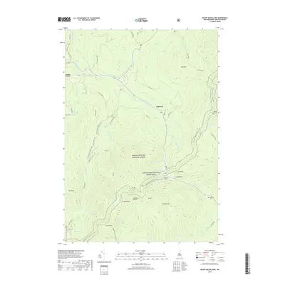
2018 Map of Mount Moosilauke
USGS Topo · Published 2018About this map
White Mountain National Forest dominates this topographic landscape, defined by the high peaks of the White Mountains and the dramatic passage through Kinsman Notch. The massive presence of Mt Moosilauke anchors the southern half of the map, where the Moosilauke Carriage Rd and several trails ascend toward South Peak. Steep terrain is further articulated by the Jobildunk Ravine and peaks like Mt Blue, Mt Jim, and Mt Waternomee.
Find a feature on this map
52 named features on this map. Tap any name to fly to it.
Don’t see what you’re looking for? This feature index may not catch every label — zoom into the map to look around manually.
Map Details
Editions of this 2018 Mount Moosilauke Map
This is the sole edition of this map. No revisions or reprints were ever made.
Other maps of this area

1928 · Plymouth
USGS Topo · 1:62,500

1928 · Rumney
USGS Topo · 1:62,500

1929 · Moosilauke
USGS Topo · 1:62,500

1929 · Franconia
USGS Topo · 1:62,500

1931 · Plymouth
USGS Topo · 1:62,500

1932 · Franconia
USGS Topo · 1:62,500

1932 · Rumney
USGS Topo · 1:62,500

1932 · Moosilauke
USGS Topo · 1:62,500

1949 · Portland
USGS Topo · 1:250,000

1950 · Lewiston
USGS Topo · 1:250,000