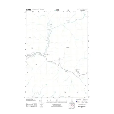
2012 Map of Mount Osceola
USGS Topo · Published 2012About this map
Mount Osceola and the surrounding peaks of the White Mountains define this high-altitude landscape as it appeared in the early 2010s. The area is a network of water and wilderness, where the E Br Pemigewasset River and Hancock Br gather runoff from prominent heights like Whaleback Mountain, Mount Hitchcock, and Scar Ridge. For those tracing the evolution of forest recreation and backcountry infrastructure, the map details established sites such as Hancock Campground, Big Rock Campground, and several remote outposts including Camp 9 Shelter and Franconia Shelter. Significant natural features such as Franconia Falls and the secluded Greeley Ponds at Mad River Notch indicate the enduring appeal of the region's mountain geography. The road system is dominated by the winding route providing access to the Hancock Overlook and the Otter Rocks Rest Area, supporting travel through this densely forested terrain.
Find a feature on this map
46 named features on this map. Tap any name to fly to it.
Don’t see what you’re looking for? This feature index may not catch every label — zoom into the map to look around manually.
Map Details
Editions of this 2012 Mount Osceola Map
This is the sole edition of this map. No revisions or reprints were ever made.
Other maps of this area

1895 · Crawford Notch
USGS Topo · 1:62,500

1896 · Crawford Notch
USGS Topo · 1:62,500

1928 · Plymouth
USGS Topo · 1:62,500

1929 · Franconia
USGS Topo · 1:62,500

1931 · Plymouth
USGS Topo · 1:62,500

1931 · Mt. Chocorua
USGS Topo · 1:62,500

1932 · Franconia
USGS Topo · 1:62,500

1946 · Crawford Notch
USGS Topo · 1:62,500

1949 · Portland
USGS Topo · 1:250,000
1950 · Crawford Notch
USGS Topo · 1:62,500