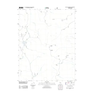
2012 Map of Mount Patterson
USGS Topo · Published 2012About this map
Mount Patterson stands as the central landmark in this high-altitude corner of the Sweetwater Mountains, where the California-Nevada border meets among the peaks and canyons. The landscape is defined by its seasonal water sources and isolated outposts, such as the remote Belfort settlement and Boulder Flat. The network of forest service roads and numbered trails connects historic sites like Sheeles Camp and Nugent Cabin, providing a glimpse into the pastoral and prospecting history of the region. Drainage patterns are dominated by Deep Cr, Desert Cr, and Swauger Cr, which carve through the terrain between prominent summits like South Sister and Wheeler Peak. Lobdell Lake serves as a significant water feature in the northwest, while the southeastern reaches give way to the open expanse of Long Meadow. This documentation reflects the enduring geography of the Mono County backcountry, emphasizing the relationship between established mountain camps and the complex hydrological systems of the Great Basin edge.
Find a feature on this map
43 named features on this map. Tap any name to fly to it.
Don’t see what you’re looking for? This feature index may not catch every label — zoom into the map to look around manually.
Map Details
Editions of this 2012 Mount Patterson Map
This is the sole edition of this map. No revisions or reprints were ever made.
Other maps of this area

1891 · Wellington
USGS Topo · 1:125,000

1893 · Wellington
USGS Topo · 1:125,000

1909 · Bridgeport
USGS Topo · 1:125,000

1911 · Bridgeport
USGS Topo · 1:125,000

1920 · Bridgeport
USGS Topo · 1:125,000

1948 · Walker Lake
USGS Topo · 1:250,000

1954 · Chris Flat
USGS Topo · 1:24,000

1954 · Fales Hot Springs
USGS Topo · 1:24,000

1956 · Desert Creek Peak
USGS Topo · 1:62,500

1956 · Fales Hot Springs
USGS Topo · 1:62,500