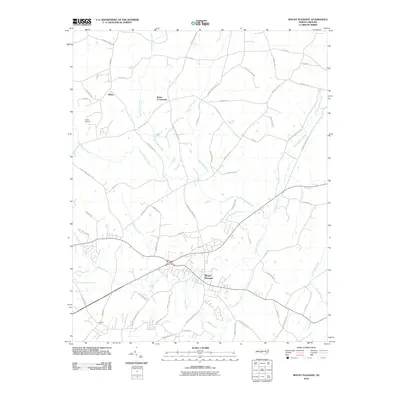
2010 Map of Mount Pleasant
USGS Topo · Published 2010About this map
Mount Pleasant serves as the primary hub of this eastern Cabarrus County landscape, situated at the intersection of several regional thoroughfares including Mount Pleasant Rd S and Mount Pleasant Rd N. The area is defined by a dense network of tributaries that feed into Dutch Buffalo Creek, which winds southward across the terrain. Smaller rural settlements like Rimer and Watts Crossroads are connected by namesake routes such as Rimer Rd and Cline School Rd, illustrating a pattern of growth tied to early schoolhouses and family-named homesteads. In the northwest, Camp Spencer is positioned near the headwaters of Jennie Wolf Creek. The map provides a detailed view of the transition between historic crossroads and more contemporary residential developments around Faggart and the McAllister Creek drainage.
Find a feature on this map
62 named features on this map. Tap any name to fly to it.
Don’t see what you’re looking for? This feature index may not catch every label — zoom into the map to look around manually.
Map Details
Editions of this 2010 Mount Pleasant Map
This is the sole edition of this map. No revisions or reprints were ever made.
Other maps of this area

1893 · Statesville
USGS Topo · 1:125,000

1941 · Charlotte
USGS Topo · 1:125,000

1942 · Charlotte
USGS Topo · 1:125,000

1949 · Concord SE
USGS Topo · 1:24,000

1950 · Concord
USGS Topo · 1:24,000

1953 · Charlotte
USGS Topo · 1:250,000

1954 · Charlotte
USGS Topo · 1:250,000

1957 · Mount Pleasant
USGS Topo · 1:62,500

1960 · Charlotte
USGS Topo · 1:250,000

1962 · Charlotte
USGS Topo · 1:250,000