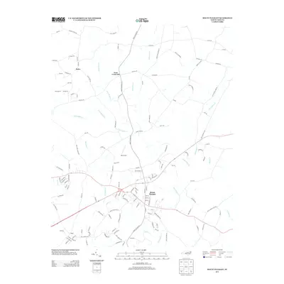
2013 Map of Mount Pleasant
USGS Topo · Published 2013About this map
Mount Pleasant serves as the central hub of this eastern Cabarrus County landscape, where a dense network of residential streets meets a rural surroundings defined by creek drainage systems. The town is situated near the convergence of Adams Cr and Dutch Buffalo Cr, with the latter winding through the quadrangle alongside smaller tributaries like McAllister Cr and Jennie Wolf Cr. To the north and west, smaller crossroads and community nodes such as Rimer, Watts Crossroads, and Faggart mark the transition into more open agricultural land and wooded tracts. This 2013 survey illustrates the area's development through family-named thoroughfares and landmarks, including West Airport and the recreational grounds of Camp Spencer. The map provides a detailed view of the regional road network, from major routes like Mount Pleasant Rd to local connectors like Phaniel Church Rd and Lentz Harness Shop Rd S.
Find a feature on this map
137 named features on this map. Tap any name to fly to it.
Don’t see what you’re looking for? This feature index may not catch every label — zoom into the map to look around manually.
Map Details
Editions of this 2013 Mount Pleasant Map
This is the sole edition of this map. No revisions or reprints were ever made.
Other maps of this area

1893 · Statesville
USGS Topo · 1:125,000

1941 · Charlotte
USGS Topo · 1:125,000

1942 · Charlotte
USGS Topo · 1:125,000

1949 · Concord SE
USGS Topo · 1:24,000

1950 · Concord
USGS Topo · 1:24,000

1953 · Charlotte
USGS Topo · 1:250,000

1954 · Charlotte
USGS Topo · 1:250,000

1957 · Mount Pleasant
USGS Topo · 1:62,500

1960 · Charlotte
USGS Topo · 1:250,000

1962 · Charlotte
USGS Topo · 1:250,000