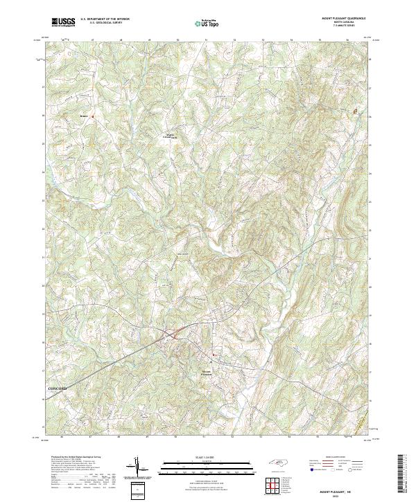
2022 Map of Mount Pleasant
USGS Topo · Published 2022About this map
Mount Pleasant serves as the primary hub of this eastern Cabarrus County landscape, situated at the junction of several key regional thoroughfares including Gold Hill Rd and Mount Pleasant Rd N. The terrain is defined by a dense network of watercourses, most notably Dutch Buffalo Cr and its tributaries like Black Run Cr and Little Buffalo Cr, which create a complex system of ridges and valleys. Small historic settlements such as Rimer and Watts Crossroads appear to the north, while the southwestern corner touches the periphery of Concord. Outdoor recreation and local infrastructure are represented by the Buffalo Creek Preserve Trail and the West Airport. This 2022 survey captures a transition between traditional rural farmland and increasing suburban residential development, marked by numerous private drives and rural roads like Phaniel Church Rd and Saint Johns Church Rd.
Find a feature on this map
113 named features on this map. Tap any name to fly to it.
Don’t see what you’re looking for? This feature index may not catch every label — zoom into the map to look around manually.
Map Details
Editions of this 2022 Mount Pleasant Map
This is the sole edition of this map. No revisions or reprints were ever made.
Other maps of this area

1893 · Statesville
USGS Topo · 1:125,000

1941 · Charlotte
USGS Topo · 1:125,000

1942 · Charlotte
USGS Topo · 1:125,000

1949 · Concord SE
USGS Topo · 1:24,000

1950 · Concord
USGS Topo · 1:24,000

1953 · Charlotte
USGS Topo · 1:250,000

1954 · Charlotte
USGS Topo · 1:250,000

1957 · Mount Pleasant
USGS Topo · 1:62,500

1960 · Charlotte
USGS Topo · 1:250,000

1962 · Charlotte
USGS Topo · 1:250,000