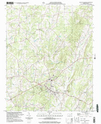
2002 Map of Mount Pleasant
USGS Topo · Published 2003About this map
Mount Pleasant serves as the primary hub in this corner of Cabarrus County, where the landscape is defined by the winding paths of Dutch Buffalo Creek and its many tributaries. The area's communal life is anchored by a significant concentration of country churches, including Prosperity Ch, Mt Carmel Ch, and Victory Temple. These landmarks, along with small burial sites like Roger Cem, provide critical points of reference for genealogists tracing family roots in this region of the North Carolina Piedmont.
Find a feature on this map
30 named features on this map. Tap any name to fly to it.
Don’t see what you’re looking for? This feature index may not catch every label — zoom into the map to look around manually.
Map Details
Editions of this 2002 Mount Pleasant Map
This is the sole edition of this map. No revisions or reprints were ever made.
Other maps of this area

1893 · Statesville
USGS Topo · 1:125,000

1941 · Charlotte
USGS Topo · 1:125,000

1942 · Charlotte
USGS Topo · 1:125,000

1949 · Concord SE
USGS Topo · 1:24,000

1950 · Concord
USGS Topo · 1:24,000

1953 · Charlotte
USGS Topo · 1:250,000

1954 · Charlotte
USGS Topo · 1:250,000

1957 · Mount Pleasant
USGS Topo · 1:62,500

1960 · Charlotte
USGS Topo · 1:250,000

1962 · Charlotte
USGS Topo · 1:250,000