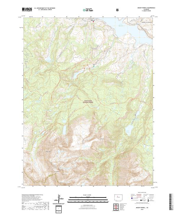
2022 Map of Mount Powell
USGS Topo · Published 2022About this map
Green Mountain Reservoir sits at the northern edge of this high-altitude landscape, where the waters of the Blue River meet the southern reaches of the Williams Fork Mountains. The terrain rises sharply toward the south, culminating in the jagged summits of Mt Powell and Eagles Nest along the Gore Range. This area, protected within the White River National Forest, is defined by a dense network of glacial lakes and alpine drainages. Notable water features like Cataract Lake, Black Lake, and the engineered Hoagland Reservoir Number 1 indicate a region shaped by both natural beauty and water management. Early ranching footprints are evident at Spring Creek Ranch near Heeney Road, while an extensive trail system, including the Gore Range Trl and Eaglesmere Trl, provides access to the remote peaks and basins that straddle the boundary of Summit and Eagle counties.
Find a feature on this map
50 named features on this map. Tap any name to fly to it.
Don’t see what you’re looking for? This feature index may not catch every label — zoom into the map to look around manually.
Map Details
Editions of this 2022 Mount Powell Map
This is the sole edition of this map. No revisions or reprints were ever made.
Other maps of this area

1929 · Dillon
USGS Topo · 1:62,500

1933 · Mt. Powell
USGS Topo · 1:48,000

1933 · Ute Peak
USGS Topo · 1:62,500

1934 · Minturn
USGS Topo · 1:62,500

1934 · Dillon
USGS Topo · 1:62,500

1937 · Ute Peak
USGS Topo · 1:62,500

1940 · Mount Powell
USGS Topo · 1:62,500

1950 · Minturn
USGS Topo · 1:62,500

1957 · Leadville
USGS Topo · 1:250,000

1959 · Leadville
USGS Topo · 1:250,000