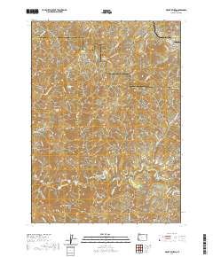
2020 Map of Mount Reuben
USGS Topo · Published 2020About this map
The Rogue River cuts across the southern portion of this terrain, marked by the prominent Grave Creek Bridge and the turbulent waters of Grave Creek Falls. This steep landscape at the boundary of Douglas and Josephine counties is defined by its network of deep drainages and ridges, including the peak of Mt Reuben. A history of resource extraction and pioneer activity is evident in the naming of numerous gulches such as Gold Bug Gulch, California Gulch, and Ajax Gulch, likely indicating the mining interests that once moved through these canyons. North of the river, the land rises toward Perkins Prairie and the aptly named Hungry Hill. Transportation in this remote area relies on a system of forest roads, including Cow Creek Rd and Lower Graves Creek Rd, which follow the natural contours of the creeks and ridges.
Find a feature on this map
67 named features on this map. Tap any name to fly to it.
Don’t see what you’re looking for? This feature index may not catch every label — zoom into the map to look around manually.
Map Details
Editions of this 2020 Mount Reuben Map
This is the sole edition of this map. No revisions or reprints were ever made.
Other maps of this area

1904 · Riddle
USGS Topo · 1:125,000

1946 · Galice
USGS Topo · 1:62,500

1946 · Dutchman Butte
USGS Topo · 1:62,500

1948 · Galice
USGS Topo · 1:62,500

1948 · Dutchman Butte
USGS Topo · 1:62,500

1954 · Glendale
USGS Topo · 1:62,500

1954 · Canyonville
USGS Topo · 1:62,500

1955 · Medford
USGS Topo · 1:250,000

1957 · Medford
USGS Topo · 1:250,000

1958 · Medford
USGS Topo · 1:250,000