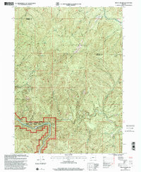
1998 Map of Mount Reuben
USGS Topo · Published 2001About this map
Mount Reuben dominates this high-country landscape along the border of Douglas and Josephine counties, where legacy mining operations and water resources define the local geography. The map documents a rugged interior network of gulches and creeks, most notably the Rogue River corridor designated as the Rogue National Wild and Scenic River. This southern section features the turbulent Grave Creek Rapids and the historic crossing at Grave Creek Bridge, alongside the picturesque Stair Creek Falls.
Find a feature on this map
38 named features on this map. Tap any name to fly to it.
Don’t see what you’re looking for? This feature index may not catch every label — zoom into the map to look around manually.
Map Details
Editions of this 1998 Mount Reuben Map
This is the sole edition of this map. No revisions or reprints were ever made.
Other maps of this area

1904 · Riddle
USGS Topo · 1:125,000

1946 · Galice
USGS Topo · 1:62,500

1946 · Dutchman Butte
USGS Topo · 1:62,500

1948 · Galice
USGS Topo · 1:62,500

1948 · Dutchman Butte
USGS Topo · 1:62,500

1954 · Glendale
USGS Topo · 1:62,500

1954 · Canyonville
USGS Topo · 1:62,500

1955 · Medford
USGS Topo · 1:250,000

1957 · Medford
USGS Topo · 1:250,000

1958 · Medford
USGS Topo · 1:250,000