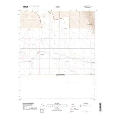
2023 Map of Mount Riley SE
USGS Topo · Published 2023About this map
The international border between the United States and Mexico defines the southern edge of this desert landscape, where the Chihuahuan terrain transitions into the federally protected Organ Mountains-Desert Peaks National Monument. In the northeastern corner, the steep contours of the East Potrillo Mountains dominate the horizon, while the surrounding basin is marked by sparse but essential infrastructure for life in the arid borderlands. Water management features like Sand Tank and Border Tank are located alongside remote thoroughfares such as A003 Co Rd and Co Rd A004. The presence of the Riley Black Standpipe Mount suggests the specialized utility and navigation points required for managing and traversing this stretch of Doña Ana County during the early twenty-first century.
Find a feature on this map
14 named features on this map. Tap any name to fly to it.
Don’t see what you’re looking for? This feature index may not catch every label — zoom into the map to look around manually.
Map Details
Editions of this 2023 Mount Riley SE Map
This is the sole edition of this map. No revisions or reprints were ever made.
Other maps of this area

1917 · Noria
USGS Topo · 1:62,500

1917 · Mt. Riley
USGS Topo · 1:62,500

1918 · Mt. Riley
USGS Topo · 1:62,500

1918 · Noria
USGS Topo · 1:62,500

1929 · Mt. Riley
USGS Topo · 1:62,500

1951 · Mt. Riley
USGS Topo · 1:62,500

1953 · El Paso
USGS Topo · 1:250,000

1959 · El Paso
USGS Topo · 1:250,000

1964 · El Paso
USGS Topo · 1:250,000

1965 · El Paso
USGS Topo · 1:250,000