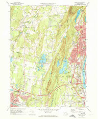
1972 Map of Mount Tom
USGS Topo · Published 1974About this map
Holyoke and its neighboring mill towns are defined here by the steep ridge of the Mount Tom Range and the industrial corridor of the Connecticut River. This early 1970s landscape shows a transition between dense urban centers and the spreading suburban developments in Westfield and Southampton. The Penn Central railroad lines trace the lowland routes, serving industrial sites while newer infrastructure like the Mass Turnpike and Interstate 91 reshape the local geography. Notable institutional landmarks such as the Soldiers Home, the Dominican Monastery, and the Childrens Home appear alongside local recreational spaces like Mountain Park and the Southampton Country Club. The map also captures the ecological complexity of the region, from the McLean Reservoir and Whiting Street Reservoir to the numerous smaller water bodies like Pequot Pond and Horse Pond that cluster near Hampton Ponds State Park.
Find a feature on this map
90 named features on this map. Tap any name to fly to it.
Don’t see what you’re looking for? This feature index may not catch every label — zoom into the map to look around manually.
Map Details
Editions of this 1972 Mount Tom Map
3 editions found
Other maps of this area

1885 · Northampton
USGS Topo · 1:62,500

1886 · Springfield
USGS Topo · 1:62,500

1886 · Chesterfield
USGS Topo · 1:62,500

1886 · Northampton
USGS Topo · 1:62,500

1887 · Granville
USGS Topo · 1:62,500

1888 · Chesterfield
USGS Topo · 1:62,500

1889 · Springfield
USGS Topo · 1:62,500

1889 · Granville
USGS Topo · 1:62,500

1891 · Northampton
USGS Topo · 1:62,500

1893 · Northampton
USGS Topo · 1:62,500