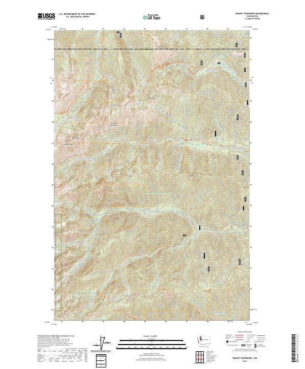
2023 Map of Mount Townsend
USGS Topo · Published 2023About this map
Mt Townsend and the surrounding high peaks of the Olympic Mountains dominate this high-elevation landscape within the Buckhorn Wilderness. This 2023 survey provides a detailed look at the complex trail networks and protected lands managed by the Olympic National Forest and Olympic National Park. The topography is defined by sharp ridgelines such as Welch Peaks and Buckhorn Mtn, with drainage systems feeding the Big Quilcene River and Tunnel Creek. High-altitude water bodies, including Silver Lake, Buckhorn Lake, and the Charlie Lakes, are scattered throughout the backcountry. These remote features are connected by established routes like the Pacific Northwest National Scenic Tri and the Tull Canyon Tri, reflecting a landscape dedicated to preservation and recreation rather than industrial or residential development. The boundary between Clallam Co and Jefferson Co cuts across the northern portion of the map near Sink Lake.
Find a feature on this map
44 named features on this map. Tap any name to fly to it.
Don’t see what you’re looking for? This feature index may not catch every label — zoom into the map to look around manually.
Map Details
Editions of this 2023 Mount Townsend Map
This is the sole edition of this map. No revisions or reprints were ever made.
Other maps of this area

1936 · Point Misery
USGS Topo · 1:62,500

1938 · Mt Constance
USGS Topo · 1:125,000

1940 · Point Misery
USGS Topo · 1:62,500

1940 · Quilcene
USGS Topo · 1:62,500

1946 · Tyler Peak
USGS Topo · 1:62,500

1947 · The Brothers
USGS Topo · 1:62,500

1948 · Tyler Peak
USGS Topo · 1:62,500

1950 · The Brothers
USGS Topo · 1:62,500

1953 · Mt. Walker
USGS Topo · 1:24,000
1953 · Brinnon
USGS Topo · 1:24,000