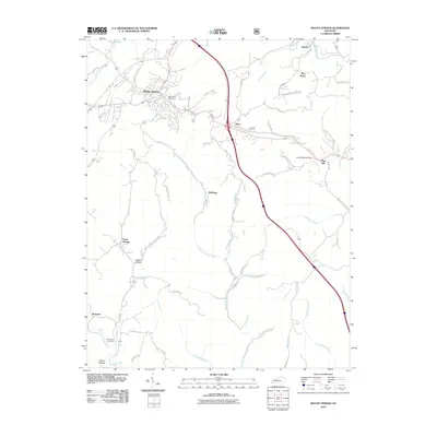
2010 Map of Mount Vernon
USGS Topo · Published 2010About this map
Mount Vernon serves as the focal point of this Rockcastle County landscape, where the town layout is bordered by the waters of Lake Linville and the winding Little Renfro Creek. This 2010 survey illustrates a region defined by its narrow hollows and numerous small settlements, including Orlando, Burr, and Pine Hill. The terrain is deeply etched by a complex drainage system, primarily the East Fork Skegg Creek and its many tributaries like Rash Branch and Calloway Branch.
Find a feature on this map
60 named features on this map. Tap any name to fly to it.
Don’t see what you’re looking for? This feature index may not catch every label — zoom into the map to look around manually.
Map Details
Editions of this 2010 Mount Vernon Map
This is the sole edition of this map. No revisions or reprints were ever made.
Other maps of this area

1893 · London
USGS Topo · 1:125,000

1897 · London
USGS Topo · 1:125,000

1952 · Billows
USGS Topo · 1:24,000

1952 · Shopville
USGS Topo · 1:24,000

1952 · Bernstadt
USGS Topo · 1:24,000

1953 · Johnetta
USGS Topo · 1:24,000

1953 · Maretburg
USGS Topo · 1:24,000

1953 · Wildie
USGS Topo · 1:24,000

1953 · Livingston
USGS Topo · 1:24,000
1953 · Brodhead
USGS Topo · 1:24,000