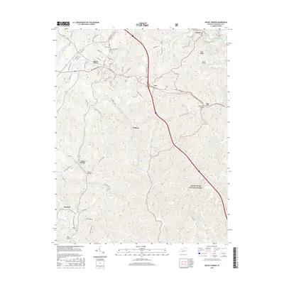
2016 Map of Mount Vernon
USGS Topo · Published 2016About this map
Mount Vernon serves as the regional hub for this portion of Rockcastle County, where modern infrastructure like Pleasant Valley Rd and S Wilderness Rd intersects with the historic traces of the Old Dixie Hwy. The landscape transitions from the urbanized streets of the county seat to the protected timberlands of the Daniel Boone National Forest in the southeast. Numerous small hollows, such as Boone Hollow and Lime Plant Hollow, highlight the area's intricate drainage system feeding into Roundstone Creek and Skeggs Cr. For genealogists, the map identifies local burial grounds including Elmwood Cem near the town center and Lover Cem near Burr. The presence of outlying communities like Sand Springs and Wellhope illustrates a settlement pattern defined by the winding creek valleys and the ridge-top roads that connect them across the central Kentucky uplands.
Find a feature on this map
81 named features on this map. Tap any name to fly to it.
Don’t see what you’re looking for? This feature index may not catch every label — zoom into the map to look around manually.
Map Details
Editions of this 2016 Mount Vernon Map
This is the sole edition of this map. No revisions or reprints were ever made.
Other maps of this area

1893 · London
USGS Topo · 1:125,000

1897 · London
USGS Topo · 1:125,000

1952 · Billows
USGS Topo · 1:24,000

1952 · Shopville
USGS Topo · 1:24,000

1952 · Bernstadt
USGS Topo · 1:24,000

1953 · Johnetta
USGS Topo · 1:24,000

1953 · Maretburg
USGS Topo · 1:24,000

1953 · Wildie
USGS Topo · 1:24,000

1953 · Livingston
USGS Topo · 1:24,000
1953 · Brodhead
USGS Topo · 1:24,000