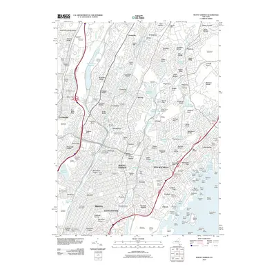
2010 Map of Mount Vernon
USGS Topo · Published 2010About this map
The Bronx River and Hutchinson River corridors anchor this 2010 map of Westchester County and the northern Bronx, illustrating a landscape of established suburban density and carefully preserved green space. The extensive grounds of Woodlawn Cemetery and the sprawling Grassy Sprain Reservoir provide significant breaks in the residential fabric, while the presence of the Yonkers Raceway highlights the area's long-standing recreational infrastructure. This era of the New York suburbs is defined by its complex transit network, featuring numerous arterial parkways such as the Sprain Brook Pkwy and Saw Mill River Pkwy.
Find a feature on this map
183 named features on this map. Tap any name to fly to it.
Don’t see what you’re looking for? This feature index may not catch every label — zoom into the map to look around manually.
Map Details
Editions of this 2010 Mount Vernon Map
This is the sole edition of this map. No revisions or reprints were ever made.
Other maps of this area

1891 · Harlem
USGS Topo · 1:62,500

1892 · Stamford
USGS Topo · 1:62,500

1892 · Tarrytown
USGS Topo · 1:62,500

1893 · Stamford
USGS Topo · 1:62,500

1893 · Tarrytown
USGS Topo · 1:62,500

1897 · Harlem
USGS Topo · 1:62,500

1897 · Oyster Bay
USGS Topo · 1:62,500

1898 · Harlem
USGS Topo · 1:62,500

1898 · Oyster Bay
USGS Topo · 1:62,500

1899 · Stamford
USGS Topo · 1:62,500