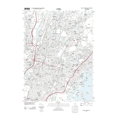
2013 Map of Mount Vernon
USGS Topo · Published 2013About this map
Yonkers Raceway and the Saint Josephs Seminary and Coll anchor the dense landscape of lower Westchester County in this early 21st-century study. The region is defined by its complex network of parkways and river corridors, where the Hutchinson River and the Bronx River flow southward toward Long Island Sound. This coastal interface is marked by a chain of islands and points, including Davids Island, Huckleberry Island, and Davenport Neck near Echo Bay.
Find a feature on this map
177 named features on this map. Tap any name to fly to it.
Don’t see what you’re looking for? This feature index may not catch every label — zoom into the map to look around manually.
Map Details
Editions of this 2013 Mount Vernon Map
This is the sole edition of this map. No revisions or reprints were ever made.
Other maps of this area

1891 · Harlem
USGS Topo · 1:62,500

1892 · Stamford
USGS Topo · 1:62,500

1892 · Tarrytown
USGS Topo · 1:62,500

1893 · Stamford
USGS Topo · 1:62,500

1893 · Tarrytown
USGS Topo · 1:62,500

1897 · Harlem
USGS Topo · 1:62,500

1897 · Oyster Bay
USGS Topo · 1:62,500

1898 · Harlem
USGS Topo · 1:62,500

1898 · Oyster Bay
USGS Topo · 1:62,500

1899 · Stamford
USGS Topo · 1:62,500