2023 Map of Mount Vernon
USGS Topo · Published 2023About this map
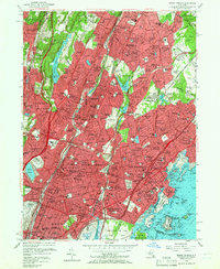
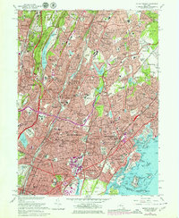
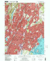
Saint Paul's Church National Historic Site stands as a focal point of this urbanized Westchester County landscape, which is defined by its deep historical roots and dense educational and religious institutions. The map reveals a complex network of parkways, including the Saw Mill River Pkwy and Bronx River Pkwy, which parallel the older rail corridors of the Metro-North. This infrastructure facilitated the development of residential enclaves such as Bronxville Heights and Lawrence Park, while large institutional tracts like Saint Josephs Seminary and College and Sarah Lawrence College preserved significant open space. Along the southern edge, the Long Island Sound shoreline is a maze of islands and necks, from Glen Island to Davenport Neck, illustrating the maritime character of the New York and Mount Vernon borderlands.
Find a feature on this map
162 named features on this map. Tap any name to fly to it.
Don’t see what you’re looking for? This feature index may not catch every label — zoom into the map to look around manually.
Map Details
Editions of this 2023 Mount Vernon Map
This is the sole edition of this map. No revisions or reprints were ever made.
Historical Maps of Quaker Ridge Through Time
4 maps found