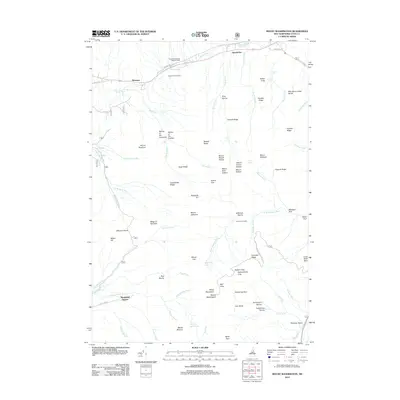
2012 Map of Mount Washington
USGS Topo · Published 2012About this map
White Mountains peaks dominate this survey, centered on the massif where the Mount Washington Auto Rd winds toward the highest summit. The landscape is defined by its extreme alpine topography, from the deep glacial cirques of Tuckerman Ravine and Huntington Ravine to the high-elevation Lakes of the Clouds. Transport networks are concentrated in the lower valleys and notches, including the Base Station serving the cog railway and the small settlements of Appalachia and Bowman along the northern rail corridor and Valley Rd. The map meticulously details the drainage systems that feed the regional rivers, such as the Ammonoosuc River and the Peabody River, while identifying remote landmarks like Great Gulf Shelter and Edmands Col that facilitate movement through this high-altitude terrain.
Find a feature on this map
88 named features on this map. Tap any name to fly to it.
Don’t see what you’re looking for? This feature index may not catch every label — zoom into the map to look around manually.
Map Details
Editions of this 2012 Mount Washington Map
This is the sole edition of this map. No revisions or reprints were ever made.
Other maps of this area

1893 · Mt. Washington
USGS Topo · 1:62,500

1893 · Gorham
USGS Topo · 1:62,500

1894 · North Conway
USGS Topo · 1:62,500

1895 · Crawford Notch
USGS Topo · 1:62,500

1896 · Mt. Washington
USGS Topo · 1:62,500

1896 · Crawford Notch
USGS Topo · 1:62,500

1896 · North Conway
USGS Topo · 1:62,500

1896 · Gorham
USGS Topo · 1:62,500

1935 · Mt. Washington
USGS Topo · 1:62,500

1937 · Gorham
USGS Topo · 1:48,000
Featured Places
- Randolph, NH
- Bean's Grant, NH
- Bowman, Randolph
- Chandler's Purchase, NH
- Marshfield Station, Thompson and Meserve's Purchase