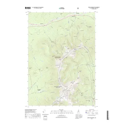
2018 Map of Mount Washington
USGS Topo · Published 2018About this map
White Mountain National Forest dominates this topographic study, anchored by the iconic peak of Mt Washington. The landscape is a complex network of high-altitude paths and technical terrain, including the Appalachian National Scenic Trail as it traverses the Presidential Range. To the west, the engineering feat of the Mt Washington Cog Ry ascends from Base Station toward the summit, while the eastern slopes are defined by the steep glacial cirques of Tuckerman Ravine and Huntington Ravine. In the northern section, the settlements of Randolph, Appalachia, and Bowman line the valley of the Moose River, serving as gateways to the extensive trail system. Historic landmarks like the Lakes of the Clouds and the Mt Washington Auto Rd illustrate the long history of alpine tourism and scientific observation in this unique New Hampshire environment.
Find a feature on this map
156 named features on this map. Tap any name to fly to it.
Don’t see what you’re looking for? This feature index may not catch every label — zoom into the map to look around manually.
Map Details
Editions of this 2018 Mount Washington Map
This is the sole edition of this map. No revisions or reprints were ever made.
Other maps of this area

1893 · Mt. Washington
USGS Topo · 1:62,500

1893 · Gorham
USGS Topo · 1:62,500

1894 · North Conway
USGS Topo · 1:62,500

1895 · Crawford Notch
USGS Topo · 1:62,500

1896 · Mt. Washington
USGS Topo · 1:62,500

1896 · Crawford Notch
USGS Topo · 1:62,500

1896 · North Conway
USGS Topo · 1:62,500

1896 · Gorham
USGS Topo · 1:62,500

1935 · Mt. Washington
USGS Topo · 1:62,500

1937 · Gorham
USGS Topo · 1:48,000
Featured Places
- Randolph, NH
- Bean's Grant, NH
- Bowman, Randolph
- Chandler's Purchase, NH
- Marshfield Station, Thompson and Meserve's Purchase