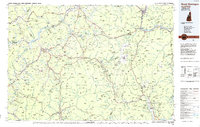
1986 Map of Mount Washington
USGS Topo · Published 1986About this map
The White Mountains dominate this mid-1980s planimetric study, which covers the intersection of New Hampshire, Vermont, and Maine. At its center, the Mount Washington Cog Railway climbs toward the summit of Mount Washington, surrounded by the peaks of the Presidential Range. This era shows a landscape managed for both timber and recreation, with the White Mountain National Forest encompassing vast tracts of high-elevation terrain. Settlement patterns follow the river valleys, most notably along the Connecticut River where the Moore Reservoir and Comerford Reservoir mark significant hydroelectric development. Industrial rail corridors remain prominent, with the Maine Central Railroad, Boston & Maine Railroad, and Canadian National Railway facilitating transport between regional centers like St Johnsbury and Berlin. The map also captures the extent of protected lands in Franconia Notch State Park and Crawford Notch State Park, preserving the character of the mountain passes.
Find a feature on this map
163 named features on this map. Tap any name to fly to it.
Don’t see what you’re looking for? This feature index may not catch every label — zoom into the map to look around manually.
Map Details
Editions of this 1986 Mount Washington Map
This is the sole edition of this map. No revisions or reprints were ever made.
Other maps of this area

1893 · Mt. Washington
USGS Topo · 1:62,500

1893 · Gorham
USGS Topo · 1:62,500

1894 · North Conway
USGS Topo · 1:62,500

1895 · Crawford Notch
USGS Topo · 1:62,500

1896 · Mt. Washington
USGS Topo · 1:62,500

1896 · Crawford Notch
USGS Topo · 1:62,500

1896 · North Conway
USGS Topo · 1:62,500

1896 · Gorham
USGS Topo · 1:62,500

1900 · Whitefield
USGS Topo · 1:62,500

1909 · Fryeburg
USGS Topo · 1:62,500