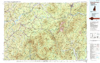
1988 Map of Mount Washington
USGS Topo · Published 1989About this map
Mount Washington stands as the central peak in this detailed topography of northern New England, a landscape where the Presidential Range meets the industrial and transport arteries of the late twentieth century. The map illustrates a complex network of railroads that once defined the region's economy, including the Maine Central RR, Boston & Maine RR, and the Grand Trunk RR. Of particular note is the Mount Washington Cog Railway, which provides a direct mechanical ascent to the summit. These rails connect valley settlements like Littleton, Whitefield, and Gorham to the higher elevations and resort areas.
Find a feature on this map
174 named features on this map. Tap any name to fly to it.
Don’t see what you’re looking for? This feature index may not catch every label — zoom into the map to look around manually.
Map Details
Editions of this 1988 Mount Washington Map
This is the sole edition of this map. No revisions or reprints were ever made.
Other maps of this area

1893 · Mt. Washington
USGS Topo · 1:62,500

1893 · Gorham
USGS Topo · 1:62,500

1894 · North Conway
USGS Topo · 1:62,500

1895 · Crawford Notch
USGS Topo · 1:62,500

1896 · Mt. Washington
USGS Topo · 1:62,500

1896 · Crawford Notch
USGS Topo · 1:62,500

1896 · North Conway
USGS Topo · 1:62,500

1896 · Gorham
USGS Topo · 1:62,500

1900 · Whitefield
USGS Topo · 1:62,500

1909 · Fryeburg
USGS Topo · 1:62,500