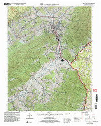
2003 Map of Mountain City
USGS Topo · Published 2004About this map
Mountain City serves as the focal point of this Johnson County landscape, where the valley floor meets the rising peaks of the Cherokee National Forest. The town’s layout is defined by the course of Roan Creek and Town Creek, with civic life anchored by several long-standing institutions including the Shouns Chapel Sch and numerous country churches. The surrounding terrain is heavily partitioned by ridges like Rainbow Ridge and Chestnut Ridge, creating distinct hollows and pockets of settlement such as Maymead and Neva.
Find a feature on this map
75 named features on this map. Tap any name to fly to it.
Don’t see what you’re looking for? This feature index may not catch every label — zoom into the map to look around manually.
Map Details
Editions of this 2003 Mountain City Map
This is the sole edition of this map. No revisions or reprints were ever made.
Other maps of this area

1891 · Abingdon
USGS Topo · 1:125,000

1893 · Cranberry
USGS Topo · 1:125,000

1894 · Abingdon
USGS Topo · 1:125,000

1895 · Cranberry
USGS Topo · 1:125,000

1899 · Cranberry
USGS Topo · 1:125,000

1902 · Cranberry
USGS Topo · 1:125,000

1909 · Abingdon
USGS Topo · 1:96,000

1911 · Abingdon
USGS Topo · 1:125,000
1935 · Doe
USGS Topo · 1:24,000

1935 · Grayson
USGS Topo · 1:24,000