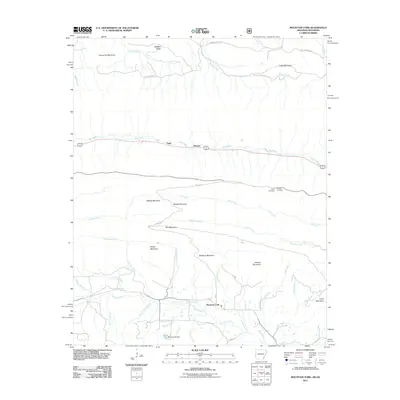
2011 Map of Mountain Fork
USGS Topo · Published 2011About this map
Mountain Fork sits within a complex drainage basin defined by the ridge-and-valley topography of the Ouachita Mountains during the early 21st century. The landscape is dominated by long, parallel ridges such as Middle Mountain, Self Mountain, and Quentin Mountain, which dictate the paths of numerous waterways. Significant hydrology includes the Kiamichi River and the namesake Mountain Fork river, which is fed by tributaries like Dark Hollow Branch and Mackey Creek. Evidence of local history and settlement is found in small clusters like Fogel and Howard, as well as the Pioneer Cemetery and Heely Cemetery situated near Skyline Dr. The presence of Reeds Lake Dam and Reeds Lake reflects water management in this heavily forested region, while the network of Forest Service roads, including FS 514, provides access through the timbered heights of Weehunt Mountain and Pine Mountain.
Find a feature on this map
47 named features on this map. Tap any name to fly to it.
Don’t see what you’re looking for? This feature index may not catch every label — zoom into the map to look around manually.
Map Details
Editions of this 2011 Mountain Fork Map
This is the sole edition of this map. No revisions or reprints were ever made.
Other maps of this area

1887 · Poteau Mountain #2
USGS Topo · 1:62,500

1890 · Poteau Mountain
USGS Topo · 1:125,000

1899 · Poteau Mountain
USGS Topo · 1:125,000

1900 · Winding Stair
USGS Topo · 1:125,000

1909 · Winding Stair
USGS Topo · 1:125,000

1950 · Mcalester
USGS Topo · 1:250,000
1958 · Loving
USGS Topo · 1:24,000
1958 · Bates
USGS Topo · 1:62,500

1958 · Potter
USGS Topo · 1:62,500

1958 · Zafra
USGS Topo · 1:24,000