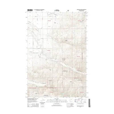
2014 Map of Mountain House
USGS Topo · Published 2014About this map
Bitterroot National Forest dominates this landscape, where the transition from managed forest lands to agricultural ranching is clearly visible. The Bitterroot Irrigation Dist Canal serves as a critical piece of infrastructure, winding through the northern portion of the map to support the local agrarian economy. This water management system is countered by the natural drainage of several prominent waterways, including Skalkaho Creek and Sleeping Child Creek, which cut through the complex network of gulches and draws. Historically named landmarks like Mtn House and Mountain House Spring suggest early mountain camps or stopovers. The area's development is marked by a blend of named ranch properties like Arrow Hill Ranch and an extensive system of forest trails and rural roads, such as Hampton Trl and Lovers Ln, illustrating the area's use for both industry and recreation.
Find a feature on this map
57 named features on this map. Tap any name to fly to it.
Don’t see what you’re looking for? This feature index may not catch every label — zoom into the map to look around manually.
Map Details
Editions of this 2014 Mountain House Map
This is the sole edition of this map. No revisions or reprints were ever made.
Other maps of this area

1901 · Hamilton
USGS Topo · 1:125,000

1909 · Sapphire
USGS Topo · 1:125,000

1947 · Butte
USGS Topo · 1:250,000

1956 · Hamilton
USGS Topo · 1:250,000

1958 · Butte
USGS Topo · 1:250,000

1959 · Hamilton
USGS Topo · 1:250,000

1960 · Butte
USGS Topo · 1:250,000

1960 · Hamilton
USGS Topo · 1:250,000

1962 · Butte
USGS Topo · 1:250,000

1964 · Hamilton
USGS Topo · 1:250,000