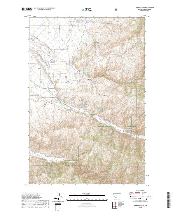
2024 Map of Mountain House
USGS Topo · Published 2024About this map
The Sapphire Mountains define the eastern rise of this landscape, where the Bitterroot National Forest covers much of the high ground and drainages. This modern survey illustrates a rugged mountain-front interface, with numerous draws and gulches like Newton Gulch and Quarry Gulch feeding into the valley floor. The geography is marked by historic water sources such as Mountain House Spring and the eponymous Mtn House landmark, alongside the prominent Tammany Hill. While much of the terrain remains managed forest, the western edge shows more contemporary road development and the presence of the Flying K Field airstrip. Clear creek systems, including Skalkaho Creek and Sleeping Child Creek, cut through the forest sections, indicating the critical role of these waterways in the Ravalli County watershed. The map provides a precise view of the complex land management boundaries between private holdings and federal forest lands during the early 21st century.
Find a feature on this map
58 named features on this map. Tap any name to fly to it.
Don’t see what you’re looking for? This feature index may not catch every label — zoom into the map to look around manually.
Map Details
Editions of this 2024 Mountain House Map
This is the sole edition of this map. No revisions or reprints were ever made.
Other maps of this area

1901 · Hamilton
USGS Topo · 1:125,000

1909 · Sapphire
USGS Topo · 1:125,000

1947 · Butte
USGS Topo · 1:250,000

1956 · Hamilton
USGS Topo · 1:250,000

1958 · Butte
USGS Topo · 1:250,000

1959 · Hamilton
USGS Topo · 1:250,000

1960 · Butte
USGS Topo · 1:250,000

1960 · Hamilton
USGS Topo · 1:250,000

1962 · Butte
USGS Topo · 1:250,000

1964 · Hamilton
USGS Topo · 1:250,000