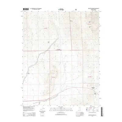
2014 Map of Mountain Springs
USGS Topo · Published 2014About this map
Mountain Springs sits at a high-elevation pass between the Las Vegas Valley and the Pahrump Valley, serving as a critical point of relief in the arid landscape of the Spring Mountains. This 2014 survey captures the settlement and its surrounding natural landmarks, including the prominent Sandstone Bluffs and the high point at Mountain Springs Summit. The terrain is defined by the eastern edge of the Toiyabe National Forest, where the higher elevations support a series of vital water sources such as Rainbow Spring, Bootleg Spring, and Warner Spring. The proximity of these springs to the historic Pahrump Rd illustrates the long-standing importance of this corridor for travel across the Mojave Desert. The map also details the deep drainage of Lovell Canyon, providing a clear view of the complex topography that governed early routes and modern development in western Clark County.
Find a feature on this map
20 named features on this map. Tap any name to fly to it.
Don’t see what you’re looking for? This feature index may not catch every label — zoom into the map to look around manually.
Map Details
Editions of this 2014 Mountain Springs Map
This is the sole edition of this map. No revisions or reprints were ever made.
Other maps of this area

1907 · Las Vegas
USGS Topo · 1:250,000

1908 · Las Vegas
USGS Topo · 1:250,000

1910 · Ivanpah
USGS Topo · 1:250,000

1912 · Ivanpah
USGS Topo · 1:250,000

1942 · Ivanpah
USGS Topo · 1:250,000

1947 · Kingman
USGS Topo · 1:250,000

1948 · Kingman
USGS Topo · 1:250,000

1952 · Blue Diamond
USGS Topo · 1:62,500

1954 · Las Vegas
USGS Topo · 1:250,000

1954 · Kingman
USGS Topo · 1:250,000