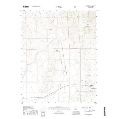
2018 Map of Mountain Springs
USGS Topo · Published 2018About this map
Mountain Springs sits as the primary settlement on this Nevada desert landscape, positioned near the critical high point of Mountain Springs Summit. The terrain is defined by the significant elevation of the Spring Mountains and the dramatic Sandstone Bluffs to the northeast. This 2018 survey illustrates a complex network of backcountry access, including Lovell Canyon Road and Saltgrass Road, which navigate the protected lands of the Toiyabe National Forest.
Find a feature on this map
28 named features on this map. Tap any name to fly to it.
Don’t see what you’re looking for? This feature index may not catch every label — zoom into the map to look around manually.
Map Details
Editions of this 2018 Mountain Springs Map
This is the sole edition of this map. No revisions or reprints were ever made.
Other maps of this area

1907 · Las Vegas
USGS Topo · 1:250,000

1908 · Las Vegas
USGS Topo · 1:250,000

1910 · Ivanpah
USGS Topo · 1:250,000

1912 · Ivanpah
USGS Topo · 1:250,000

1942 · Ivanpah
USGS Topo · 1:250,000

1947 · Kingman
USGS Topo · 1:250,000

1948 · Kingman
USGS Topo · 1:250,000

1952 · Blue Diamond
USGS Topo · 1:62,500

1954 · Las Vegas
USGS Topo · 1:250,000

1954 · Kingman
USGS Topo · 1:250,000