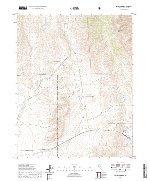
2021 Map of Mountain Springs
USGS Topo · Published 2021About this map
Toiyabe National Forest dominates this high-altitude landscape in the Spring Mountains, where the elevation culminates at Mountain Springs Summit. The map details the transition from the arid reaches of the Mojave Desert into the more rugged terrain of Lovell Canyon. This area is defined by its critical water sources, including a network of named springs such as Mule Spring, Rainbow Spring, and Warner Spring, which have long dictated movement through these passes. The small settlement of Mountain Springs sits as a lonely outpost along the winding highway, serving as a gateway between the desert floor and the wooded slopes. Prominent geological features like the Sandstone Bluffs and Sandstone Bluff provide distinct visual landmarks for navigators and surveyors alike. Modern trail management is evident through curiously named paths like Name Me Trl and Changed Ending To Wilderness? Trl, indicating ongoing forest administration.
Find a feature on this map
24 named features on this map. Tap any name to fly to it.
Don’t see what you’re looking for? This feature index may not catch every label — zoom into the map to look around manually.
Map Details
Editions of this 2021 Mountain Springs Map
This is the sole edition of this map. No revisions or reprints were ever made.
Other maps of this area

1907 · Las Vegas
USGS Topo · 1:250,000

1908 · Las Vegas
USGS Topo · 1:250,000

1910 · Ivanpah
USGS Topo · 1:250,000

1912 · Ivanpah
USGS Topo · 1:250,000

1942 · Ivanpah
USGS Topo · 1:250,000

1947 · Kingman
USGS Topo · 1:250,000

1948 · Kingman
USGS Topo · 1:250,000

1952 · Blue Diamond
USGS Topo · 1:62,500

1954 · Las Vegas
USGS Topo · 1:250,000

1954 · Kingman
USGS Topo · 1:250,000