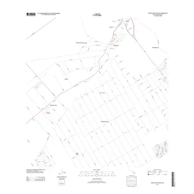
2013 Map of Mountain View
USGS Topo · Published 2013About this map
Mountain View and the surrounding agricultural communities define this section of the Puna District on the Island of Hawai'i. The landscape is dominated by a systematic grid of residential and farming subdivisions, most notably Hawaiian Acres and Fern Acres, which sit alongside historic plantation-era settlements. These smaller clusters, including Kurtistown, Iwasaki Camp, and Nine and Onehalf Mile Camp, reflect the region's history of labor housing and homesteading along the Old Volcano Rd corridor. The inland transport network is anchored by Pahoa Rd and the former Railroad Ave corridor, illustrating how early sugar and pineapple production influenced the modern layout of these windward communities. Further north, the larger town of Kea'au serves as a local hub near the Kea'au Camp and Ninemile Camp, while the Mountain View Airstrip provides a rare infrastructure point within the dense residential blocks of the interior.
Find a feature on this map
143 named features on this map. Tap any name to fly to it.
Don’t see what you’re looking for? This feature index may not catch every label — zoom into the map to look around manually.
Map Details
Editions of this 2013 Mountain View Map
This is the sole edition of this map. No revisions or reprints were ever made.
Other maps of this area

1917 · Hilo
USGS Topo · 1:62,500

1922 · Puna
USGS Topo · 1:62,500

1924 · Makuu
USGS Topo · 1:62,500

1924 · Puna
USGS Topo · 1:62,500

1924 · Kalapana
USGS Topo · 1:62,500

1932 · Hilo
USGS Topo · 1:62,500

1954 · Hawaii South
USGS Topo · 1:250,000

1954 · Hawaii North
USGS Topo · 1:250,000

1959 · Hawaii South
USGS Topo · 1:250,000

1959 · Hawaii North
USGS Topo · 1:250,000