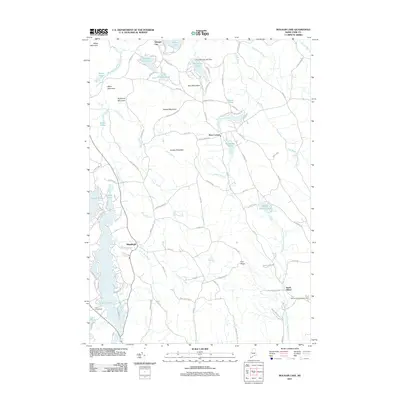
2011 Map of Mousam Lake
USGS Topo · Published 2011About this map
Mousam Lake and its intricate northern tributaries define this region of York County, where recreation and local community centers are closely tied to the water. The landscape is dotted with numerous small bodies of water, including Square Pond, Round Pond, and the Little Ossipee River, which winds through the northern portion of the map near Sprague City. These water features are complemented by significant elevations like Abbott Mountain and Hussey Mountain, creating a varied topography.
Find a feature on this map
99 named features on this map. Tap any name to fly to it.
Don’t see what you’re looking for? This feature index may not catch every label — zoom into the map to look around manually.
Map Details
Editions of this 2011 Mousam Lake Map
This is the sole edition of this map. No revisions or reprints were ever made.
Other maps of this area

1891 · Berwick
USGS Topo · 1:62,500

1891 · Kennebunk
USGS Topo · 1:62,500

1891 · Buxton
USGS Topo · 1:62,500

1891 · Newfield
USGS Topo · 1:62,500

1892 · Buxton
USGS Topo · 1:62,500

1893 · Kennebunk
USGS Topo · 1:62,500

1893 · Berwick
USGS Topo · 1:62,500

1893 · Buxton
USGS Topo · 1:62,500

1893 · Newfield
USGS Topo · 1:62,500

1898 · Kennebunk
USGS Topo · 1:62,500